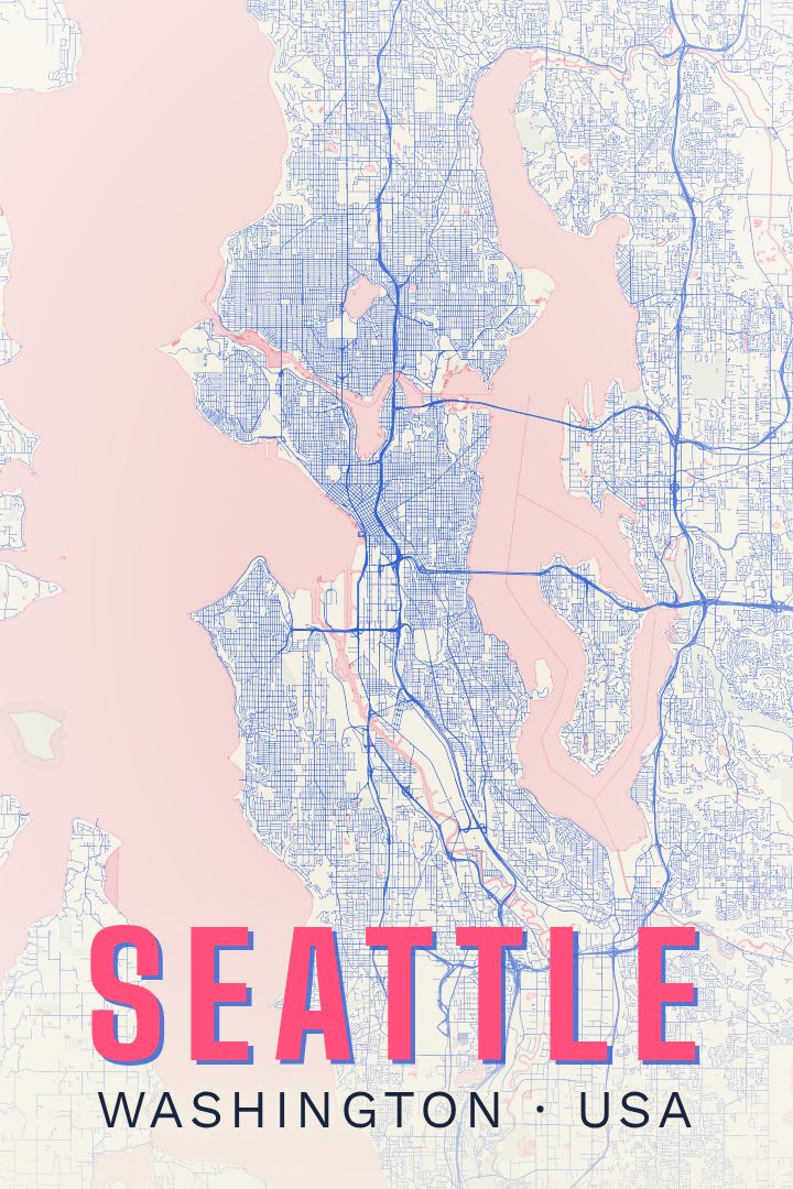
Shown at 16×24" · Archival Matte 250 gsm
Seattle City Map Poster
Picture it at home
From living room to modern office
The same Seattle artwork, shown in a 24×36 natural wood frame. Room scenes are for scale and styling; choose your exact size and material at checkout.


About this print
Seattle map poster
Seattle sits on a narrow strip of land between Elliott Bay and Lake Washington, and that squeeze shapes almost everything about it. The city climbs and drops across a series of hills, bends around Lake Union and the Ship Canal, and keeps running into water at the edges, which is why its street grid breaks and re-knits itself so often. A map of the place reads less like a tidy plan and more like a record of people building around saltwater, freshwater, and steep ground.
The surroundings matter as much as the streets. Ferries cross Puget Sound toward the Olympic Peninsula, the Cascades rise to the east, and on clear days Mount Rainier stands to the south, far enough away to look unreal and close enough to orient by. Within the city, neighborhoods like Capitol Hill, Ballard, West Seattle, and the Central District each have their own shape and pace, separated by water, bridges, and slopes rather than by anything so simple as a boundary line.
This print is for someone with a reason to keep Seattle in view: years lived there, a stretch of work or school, family across the Sound, or a visit that stuck. Hung in a hallway, an office, or beside a door, it works the way a good map does on a wall, as something to stand in front of and trace rather than glance at. It is made as art rather than as a navigation tool.
Make a custom map poster of your own routeDid it yourself? Make a poster from your own Strava activity
Map details
- Location
- Washington, United States
- Collection
- Cityscapes
You might also like
Related map posters
Part of a collection