Strava map posters
Turn a Strava activity into a map poster.
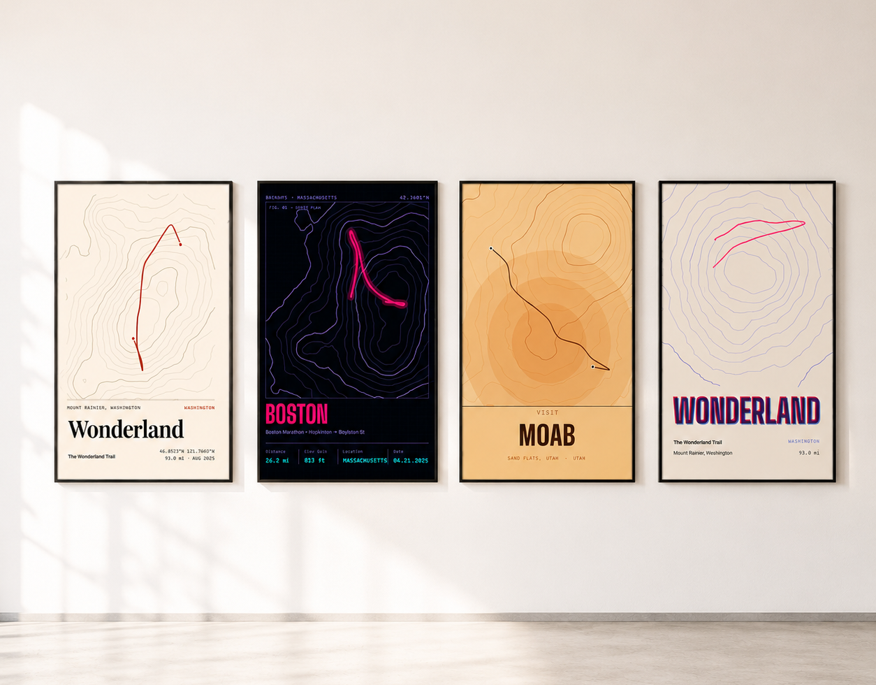
Your marathon PR, your first century, the ridge traverse you chased for three summers. Connect Strava, choose the activity, and RadMaps draws that exact route on real terrain as a poster you can print and frame.
Free to design · Pay only if you print · Ships within the U.S.
How it works
One route in. A wall-worthy map out.
01
Connect Strava
Authorize RadMaps on Strava’s own sign-in screen. You approve what RadMaps may read, and you can revoke access from Strava at any time.
02
Pick the activity
Browse your recent activities by name, date, and distance, then select the one that belongs on the wall.
03
Style and print
Set the route color, map style, terrain, title, and stats, then order the size and material you want.
What makes it a Strava poster
Your recorded line, not a redrawn approximation.
RadMaps uses the GPS track from the activity itself, so the switchbacks, the wrong turn, and the out-and-back spur are all where you actually went. Distance and elevation gain come from the same track and can be printed as part of the poster’s story.
The route is drawn over real map data: roads, trails, water, and optional hillshade and contour lines generated from elevation models. That context is what turns a squiggle from a fitness app into a map someone can read from across the room.
Ideas
Activities that make great posters.
- Marathon or ultra PR: the course line with your finish time and date as the subtitle.
- Century or gran fondo: a long ride reads beautifully on a 24×36 print.
- FKT or thru-hike section: topographic styles show every climb the route crosses.
- The home loop: the run or ride you have done a hundred times, in your club or team colors.
- A trip: a day of a bikepacking route or a hut-to-hut stage, with the place name as the title.
Privacy
Your Strava data stays yours.
By default RadMaps asks Strava only for read access to your activities, and importing an activity you marked private needs a separate, explicit permission. RadMaps reads the activity you choose to turn it into a poster; it does not post to Strava, follow anyone, or publish your route.
A poster made from a Strava activity stays private to your account unless you order it or share it yourself. If the route starts at your front door, consider framing the map a little wider or using a place name as the title instead of an address.
Questions
Strava Map Posters FAQ
Does RadMaps need my Strava password?
No. You sign in on Strava’s own page and approve access there. RadMaps never sees your Strava password, and you can revoke access from your Strava settings.
Can I use a private Strava activity?
Yes, if you choose to. Private activities need a separate, explicit permission during the Strava connection; the default connection does not request it.
What if the activity is not on Strava?
Export it as a GPX file from your watch or app and upload it instead. RadMaps accepts a GPX, GeoJSON or KML file up to 5 MB.
What sizes and materials can I order?
Every RadMaps poster uses the same 2:3 shape, printed at 8×12, 12×18, 16×24, 20×30, and 24×36 inches. Formats include archival matte posters, framed prints, wall hangings, aluminum, and acrylic; availability varies by size. The editor preview uses the same composition as the final print, so the route is not cropped or reframed after you approve it.
Is designing free, and where do you ship?
Designing and previewing a poster is free. You pay only when you order a physical print, and checkout currently accepts United States shipping addresses.
Your best activity deserves a frame
Connect Strava and design it free.