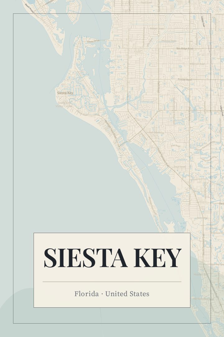
Shown at 16×24" · Archival Matte 250 gsm
Siesta Key City Map Poster
About this print
Siesta Key map poster
Siesta Key is a barrier island on Florida's Gulf coast, just offshore from Sarasota and separated from the mainland by Roberts Bay and Little Sarasota Bay. Water shapes everything about it: the Gulf of Mexico along the western shore, a narrow tangle of canals and inlets on the bay side, and two bridges carrying traffic over from the mainland. The island runs long and thin, with Siesta Beach, Crescent Beach, and Turtle Beach strung down the Gulf side and Siesta Village sitting near the north end as the walkable hub of shops and restaurants.
The beach sand is close to pure quartz, which is why it reads so white in photographs and stays cool enough to walk on at midday. That, plus the west-facing shoreline and its long run of evening light over the water, is most of the reason people keep coming back year after year. Many visitors know the island as a set of habits more than a geography: the same stretch of sand, the same bike route down Midnight Pass Road, the same walk into the village after dinner.
A map print of Siesta Key is a way to hold onto that shape. Seen from above, the island's outline and the bay side's branching waterways make a recognizable form to anyone who has spent time there, and the whole place fits comfortably on a wall. It suits a honeymoon, a family trip taken every spring, a stretch of years lived on the island, or a house that someone wishes were closer to the Gulf. It is made as art for a wall rather than for navigation.
Make a custom map poster of your own routeDid it yourself? Make a poster from your own Strava activity
Route details
- Location
- Florida, United States
- Collection
- Cityscapes
You might also like
Related map posters




Part of a collection