Shown at 16×24" · Archival Matte 250 gsm
Mohican 100 Map Poster — Blueprint Edition
Blueprint Edition • Mohican, Ohio
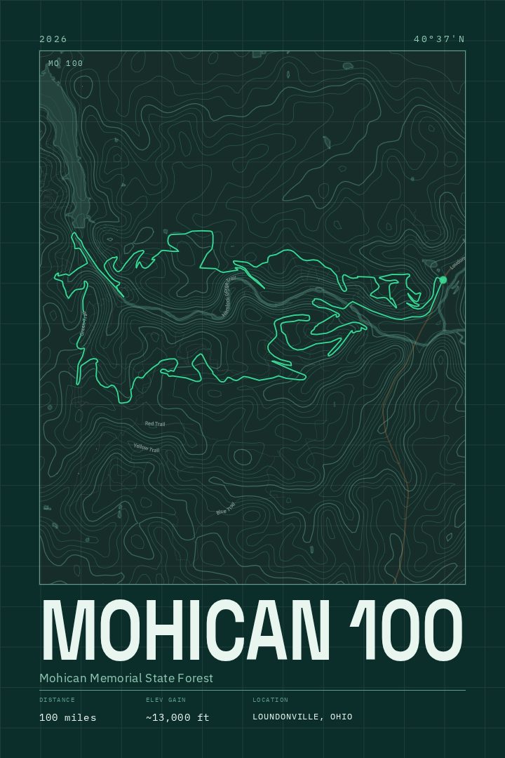
Honor the Mohican 100 with a blueprint-inspired map of the supplied 26.7 mi route through the Mohican area near Perrysville, Ohio. This elevation-rich trail running poster is made for race memories and adventure walls.
About this print
Mohican 100 map poster
The Mohican 100 runs through one of the more rugged corners of Ohio, where the land around Perrysville folds into the Clear Fork gorge and the hemlock-shaded ravines of Mohican State Park and the surrounding state forest. The 26.7-mile route mapped here gathers about 3,900 feet of climbing, which is a lot for a state better known for cornfields, and anyone who has run it knows that the elevation comes in short, repeated bites rather than one long haul. Singletrack, creek crossings, root-laced descents, and the steady sound of water in the gorge are what the trail is made of.
This print traces that course as a line on a page, drawn in the blueprint style: cool blue ground, fine pale linework, the flat clarity of a drafting sheet. It is a design treatment rather than a printing method, and it suits a route whose character is mostly about shape and gradient. Seen from above, the loop reads as geometry.
It makes sense on the wall of someone who has finished the distance, crewed for a runner, or spent weekends training on those trails in the off-season. It also reads simply as a portrait of the Mohican country for people who know the area from camping, paddling, or walking the gorge. Framed as art rather than a guide, it keeps a hard day somewhere in the room without needing a bib or a medal to explain itself.
Make a custom map poster of your own routeDid it yourself? Make a poster from your own Strava activity
Route details
- Distance
- 26.7 mi
- Elevation gain
- 3,894 ft
- Location
- Mohican, Ohio, United States
- Collection
- Runs, Trails
- Edition
- Blueprint Edition
You might also like